Official Profile
District Overview & Administrative Demographics
Sri Sathya Sai district is located in the Rayalaseema region of Andhra Pradesh, India. Formed on 4 April 2022 from the Dharmavaram, Penukonda, Kadiri, Madakasira, and Puttaparthi revenue divisions, it is named after Bhagawan Sri Sathya Sai Baba, whose globally renowned institutions brought schools, a university, free super-speciality healthcare, and drinking water projects to the region.
5
Revenue Divisions32
Administrative Mandals467
Gram Panchayats / Villages18.4 Lakhs
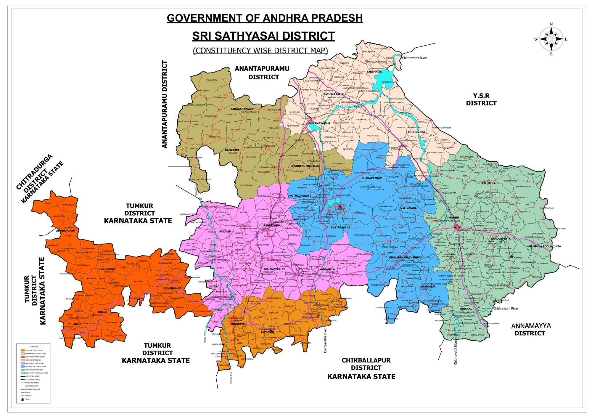
Population (2011 Census)District Map
Geography & Climate
The district lies in the Rayalaseema region, bounded by Anantapur district to the north, Annamayya and Kadapa districts to the east, and by Chitradurga, Tumakuru and Chikkaballapura districts of Karnataka to the west and south-west. The Pennar, Chitravathi, Jayamangala, Maddileru, and Papagni rivers flow through the district. Predominant soil types are red soils, with mineral reserves of gold, quartz, granite, and pyrophyllite.
Industrial & Agricultural Economy
Agriculture is centered around groundnut, silk rearing, and horticulture. The district has emerged as a major industrial hub anchored by:
- Kia India Automobile Plant: 536-acre facility at Yerramanchi village, Penukonda mandal (Annual capacity: 3.5 Lakh units).
- Berger Paints India: Advanced chemical manufacturing facility at Hindupur.
- Texport Industries: Apparel and textile manufacturing hub at Gollapuram, Hindupur.
List of 32 Mandals in Sri Sathya Sai District
Grouped across the 5 Revenue Divisions (Puttaparthi, Penukonda, Kadiri, Dharmavaram, Madakasira):